Master Plan
176.33 Kanal thoughtfully laid out — residential blocks along a tree-lined central boulevard with commercial, mosque, school, parks and green belts.
Drawing M-P-01
Margalla Springs Housing Society, Rawat
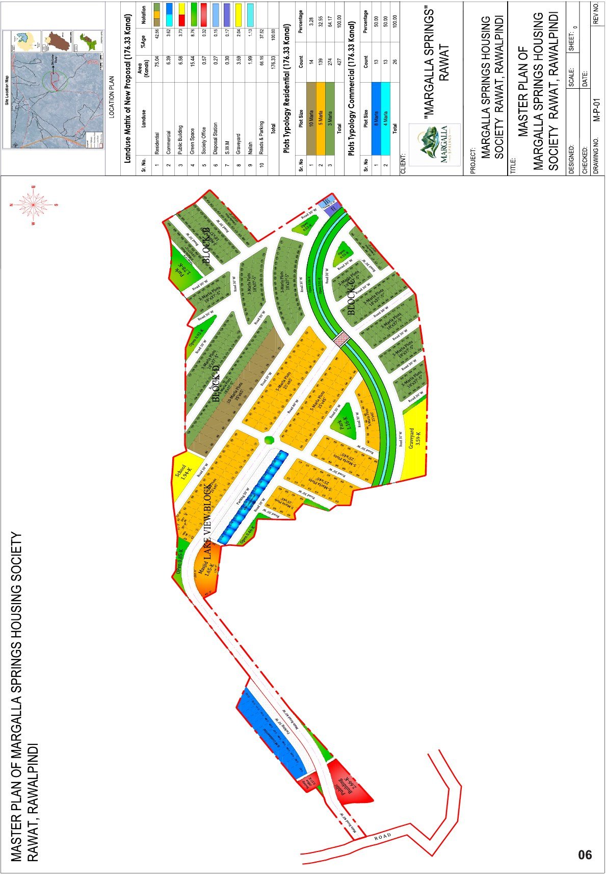
Indicative master plan. Plot positions and dimensions are subject to final approval and may be revised by the society.
Land use
How the 176 Kanal is allocated
| # | Land use | Area (Kanal) | Share |
|---|---|---|---|
| 1 | Residential | 75.04 | 42.56% |
| 2 | Commercial | 6.39 | 3.62% |
| 3 | Public buildings (mosque, school) | 6.58 | 3.73% |
| 4 | Green space | 15.44 | 8.76% |
| 5 | Society office | 0.57 | 0.32% |
| 6 | Disposal station | 0.27 | 0.15% |
| 7 | Solid waste management | 0.30 | 0.17% |
| 8 | Graveyard | 3.59 | 2.04% |
| 9 | Nullah | 1.99 | 1.13% |
| 10 | Roads & parking | 66.16 | 37.52% |
| Total | 176.33 | 100% |
Plot typology
427 residential and 26 commercial plots
2743 Marla residential
1395 Marla residential
1410 Marla residential
134 Marla commercial
138 Marla commercial
453Total plots
- 3 Marla residential274 plots · 64.17%
- 5 Marla residential139 plots · 32.55%
- 10 Marla residential14 plots · 3.28%
Want to pick your plot on the plan?
Visit the site office and our team will walk you through available plot numbers block by block.